


Nova Scotia’s Eastern and Southern Shores

After our incredible tour of Cape Breton, we continued our road trip along Nova Scotia’s Eastern and Southern shores. Those directions may seem confusing, especially given how mainland Nova Scotia follows the SW-NE axis, but a look at any tourist map will quickly make sense of it all. The Eastern shore is to the east (north?) of Halifax, and the Southern shore is to the south (west?) of Halifax. Geography aside, we had a blast driving along the coast and I quickly learned just how much there is to see on this side of the province!

Nova Scotia’s Eastern and Southern Shores
Eastern Shore
Instead of taking the faster, more efficient highway towards Halifax we opted to drive along the coast. The road along the coast was much less travelled which made for a most interesting and scenic drive, in my opinion. We stopped in the small town of Guysborough and toured the church-turned-museum, we drove along a gravel road leading to nowhere outside Ecum Secum (great name, btw), and we were constantly blown away by the similarities between the coast and Ontario’s Muskoka region!
Taylor Head Provincial Park
One of the highlights of the Eastern Shore was Taylor Head Provincial Park. We set up camp outside the nearby village of Sheet Harbour and spent the afternoon and the following morning checking out the park – in two very different weather conditions! Our first visit in the afternoon was completely overcast with the entire peninsula completely covered in a dense fog! We ate dinner in the pavilion and ventured onto the hazy grey beach before opting to try our luck the following day. We took a detour through the little town of Mushaboom on the way back to Sheet Harbour and enjoyed the waterproof interior of the car until it was time to head to bed.


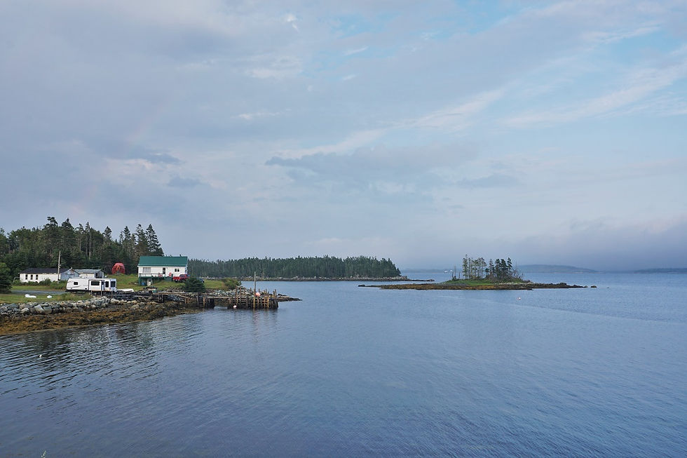
The next morning greeted us with clear blue skies with nary a rain drop in sight! It was back to Taylor Head for us, and we were positively thrilled, (despite the 5km, slow & very dusty gravel road that leads to the park entrance). We went on a wee hike around the peninsula and were blown away by the rugged coastline and seascapes.


We went back to the beach and were shocked at the contrast to the previous day! It seemed like we had visited two entirely different places! Mac and I had worked up a bit of a sweat while hiking, so we did the natural thing one does at a beach… run into the water at full tilt! That was great and all, until the water temperature set in and immediately proceeded to numb my toes and legs! This was the coldest water I’ve ever been in!!! I promptly screamed and ran out as fast as I could, shivering the whole way and watching goose-bumps develop across my entire body.


Rainbow Haven Beach
Somewhat embarrassingly Mac and I spent very little time in the city of Halifax. The day that we were there was filled with visiting the Pier 21 Immigration Museum (very interesting – highly recommend!), touring the Citadel (also quite interesting), and meeting up with two of my cousins and their partners for lunch! What little we did see of the city was awesome, and I’d definitely like to return someday! We had our dinner that night at Rainbow Haven Beach, which is a nice and easy drive from Halifax. After dinner, we watched birds and fishermen alike stroll the ocean floor at low tide and dig for clams.


Southern Shore
Lower Prospect
To the west of Halifax is the Southern Shore. Our first stop was on a tiny peninsula named Lower Prospect. The road leading there was oozing with Maritime charm. We stopped at a particularly colourful harbour for dinner before continuing to the workplace of Mac’s old co-worker, East Coast Outfitters.


ECO does kayaking tours around the islands of Prospect Bay, and we watched a group paddle in during an incredibly spectacular sunset. I went a little click-happy with my camera, but I don’t regret it one bit – this was one of the best sunsets I’ve seen in ages!!


#gallery-8585-15 { margin: auto; } #gallery-8585-15 .gallery-item { float: left; margin-top: 10px; text-align: center; width: 50%; } #gallery-8585-15 img { border: 2px solid #cfcfcf; } #gallery-8585-15 .gallery-caption { margin-left: 0; } /* see gallery_shortcode() in wp-includes/media.php */


St. Margarets Bay
We spent the night on a tent platform in the woods beside ECO and were so grateful for the hospitality from Mac’s friend. We woke up well rested the next morning and continued down the coast towards yet another incredible display of hospitality. The parents of our good friend from university live on St. Margarets Bay and graciously offered to host us for a few nights. Well, those two nights ended up being two of the best of our entire trip! M&T were so friendly and welcoming and we had the best time playing euchre and cribbage with them, lounging in their backyard, kayaking in the ocean, and admiring their impressive display of Indigenous artwork.

Peggy’s Cove
Our last excursion on Nova Scotia’s Eastern and Southern shores was to the infamous Peggy’s Cove. By this point in our trip we had been pretty lighthouse-d out, and we had considered not even making the trip to see yet another one. But with nothing else on our calendar for the day, we decided to venture back towards the other side of St. Margarets Bay and see what all the fuss was about.

Before even arriving at Peggy’s Cove, we stopped off at the memorial site for Swissair Flight 111. On September 2nd, 1998, flight SR111 experienced an uncontrolled cabin fire and crashed into the Atlantic Ocean near the entrance to St. Margarets Bay. All 229 people on board were killed. The crash site – which was roughly equidistant between Peggy’s Cove and a nearby small fishing village, Bayswater – became home to a nearly four year recovery and investigation operation. A memorial was erected soon after the crash, and the beautiful monument there pays tribute to the people who lost their lives on SR111. We stayed at the memorial site for a few quiet moments of contemplation, while taking in the stunning scenery around us. I had a feeling that the next stop on our day trip wouldn’t be quite so peaceful or serene…

The lighthouse at Peggy’s Cove (officially known as Peggys Point Lighthouse) is one of the most popular in the province (and probably the Maritimes too!). It’s not the largest, nor the most spectacular, but the rolling granite rocks that surround the lighthouse make for excellent climbing, and there’s no denying that the surrounding scenery is stunning. The lighthouse was first built in 1868 and later reconstructed to its current form in 1914.

Mac and I miraculously managed to find a parking spot in one of the overflow lots after a harrowing race with about 100 other cars. We followed the crowd of fellow visitors through the little fishing community of Peggy’s Cove (population: 30) and were quickly enamoured with the colourful seaside homes and abundant boats that filled the coastline. There exist strict land-use regulations in Peggy’s Cove, and it’s all but prohibited to undertake any property development. The community here is tight-knit and even though this area is one of the province’s biggest tourist attractions, great steps have been taken to ensure it stays quaint and authentic.


We made our way out onto the infamous rocks and after a quick glimpse at the lighthouse, spent the rest of our time just people watching. Families, couples, locals, and tourists alike all flock to this lighthouse and we had fun watching folks jump from rock to rock and pose for pictures. Less than a handful of cafes/restaurants and gift shops line the narrow street leading to the lighthouse, further emphasizing the small size of this community. Having had our fill of people-watching and picture-taking, we began the walk back to the car and watched as a race began for our coveted parking spot.


Public Safety Announcement
One particular thorn in our experience was watching some folks blatantly disregard the large and rather prominent safety signs. The rocks at Peggy’s Cove are two distinct colours – brown and black. The brown rocks are higher above sea level and are perfect for climbing and exploring the area. The black rocks are located right along the coast line and are not only slippery and moss-covered, but also the site of rogue waves. For the uninitiated, “rogue waves are unusually large, unexpected and suddenly appearing surface waves that can be extremely dangerous” (source). Just last year a teenage boy was pulled from the ocean after a rogue wave swept him off his feet. Local fishermen have pulled dozens of people out of the water. It was absolutely infuriating to watch folks clamber onto the black rocks to dip their toes in the ocean/ get the perfect picture/ ignite their daredevil passion/ etc., etc., putting not only their lives at risk, but also risking the lives of any potential good Samaritans who might be inclined to save them. So please, if you find yourself at Peggy’s Cove, follow the signs and stay off the black rocks. (End rant.)

*****
Our time spent driving along Nova Scotia’s Eastern and Southern shores was filled with stunning scenery, incredible hospitality, and a slow-paced and relaxing way of life (at least for a few days). It was so great to get off the beaten track (save for our day in Peggy’s Cove) and see some parts of the province that are often overlooked. After our days on the shore, we headed inland to flex our adventure muscles one more time. We set our sights on an easy to love National Park with a hard to pronounce name – Kejimkujik here we come!
Tell me, have you ever been to Peggy’s Cove? What’s the best sunset you’ve ever seen?
Pin It!

Never Miss a Post!
Enter your email address to subscribe to A Taste of Trace and receive notifications of new posts by email.
Email Address:
Sign Me Up!

Comments