


At the End of Gaspe…

Gaspe Peninsula, Quebec
Given how amazing our first adventures were in Gaspe National Park, Mac and I couldn’t wait to see what we’d find at the end of Gaspe. Our first few days of our East Coast road trip were spent following the 132 highway as it snaked along the shores of the St Lawrence. We loved the abundance of “Halte Routieres” (rest stops, often with toilets, water, and if you’re lucky, a view) that lined the highway. We often took advantage of the number of pull off spots to stretch our legs and admire the scenery.


Eventually highway 132 reaches the end of the peninsula and begins turning south. It continues around the bend to link up with the Gulf of St Lawrence and later, Challeur Bay. It was here that we began our adventures at the end of Gaspe.
At the End of Gaspe
Forillon National Park
Forillon was the first national park in Quebec and unfortunately comes with a sad origin story. When the park was being created in 1970, more than 220 families were bullied into leaving their homes by a private firm hired by the Quebec government. Using scare tactics on the residents to sell their homes at a lower value meant a higher profit margin for the private firm. In 2011 the House of Commons issued an official apology to the families and people whose homes were seized in the creation of Forillon National Park.

Today, the park sees around 150,000 annual visitors. It’s home to an abundance of wildlife as well as a plethora of landscapes: forests, sea coasts, marshes, cliffs, and the end of the Appalachian mountain range. Mac and I made the decision to buy a Discovery Parks Pass – a year-long pass that allows us access to every Canadian National Park and Heritage place. The $136 fee was steep at first, but it pays for itself after 7-8 days in National Parks – and we hoped we’d be able to do that on our road trip! Forillon National Park is truly at the end of Gaspe and there are a number of trails (both inside and outside the park) that really embrace the “end of the world” feeling of the peninsula. The first hike we did was actually outside the National Park, just off of Highway 132. It was a short but sweet (and insanely steep!) hike up to observation platforms that overlooked both the St Lawrence River and the Gulf of St Lawrence.


The second hike we did was out to Cap-Gaspe. After walking along the coast then through the dense forest, we eventually came to the end of Gaspe and came face to face with a huge lighthouse, and two porcupines!!! Definitely not what I was expecting to see, but enjoyable nonetheless.

#gallery-8365-20 { margin: auto; } #gallery-8365-20 .gallery-item { float: left; margin-top: 10px; text-align: center; width: 50%; } #gallery-8365-20 img { border: 2px solid #cfcfcf; } #gallery-8365-20 .gallery-caption { margin-left: 0; } /* see gallery_shortcode() in wp-includes/media.php */


After watching the porcupines for a while (from a very, very safe distance), we hiked down a small path to a lookout platform, appropriately named Land’s End. Here we were treated to some pretty incredible cliff views, as well as some glimpses of seals playing in the water below! Luckily there was a free telescope on the platform and we were able to see the seals in pretty crisp detail.


(International) Appalachian Trail
This area is pretty special for a specific group of hikers because it’s the official end point of the International Appalachian Trail. The traditional (and more well-known) Appalachian Trail finishes at the summit of Mount Katahdin in Maine. From there it continues 1000km to the north and east, through New Brunswick and Quebec to Cap-Gaspe. We saw numerous signs for the IAT during our hikes in Gaspe National Park (and we would see many more while hiking in New Brunswick). Only a very small fraction of hikers that complete the AT go on to finish the IAT. I do love hiking, but I can’t imagine hiking 1000km, let alone the rest of the AT (nearly 3500km)!
#gallery-8365-21 { margin: auto; } #gallery-8365-21 .gallery-item { float: left; margin-top: 10px; text-align: center; width: 50%; } #gallery-8365-21 img { border: 2px solid #cfcfcf; } #gallery-8365-21 .gallery-caption { margin-left: 0; } /* see gallery_shortcode() in wp-includes/media.php */


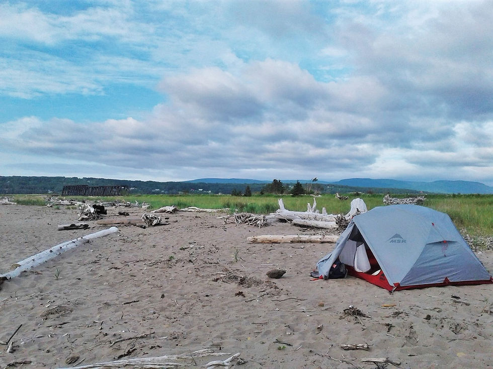
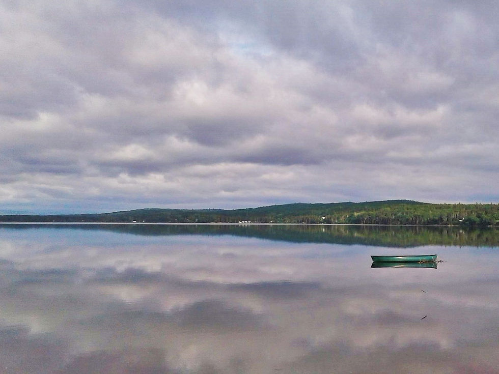
It was tiring even thinking about hiking that long, so Mac and I made tracks to get to our wild campsite for the night. We set up our tent a beach outside the town of Gaspe. There were several fellow campers on the beach that night and we were soothed to sleep by the crashing waves. By the morning, the waves had totally subsided and the water was like a sheet of glass.
#gallery-8365-22 { margin: auto; } #gallery-8365-22 .gallery-item { float: left; margin-top: 10px; text-align: center; width: 50%; } #gallery-8365-22 img { border: 2px solid #cfcfcf; } #gallery-8365-22 .gallery-caption { margin-left: 0; } /* see gallery_shortcode() in wp-includes/media.php */

Rock of Percé
After leaving Fortillon National Park and our sandy campsite, we were back on the 132 to continue our tour of the Gaspe Peninsula. We stopped in the small town of Percé, which is well known for a rather large rock. Now, that may not seem so exciting, but given the sheer size of this “rock”, and the fact that you can walk to it during low tide suddenly makes it much more attractive! We snagged a parking spot in a free lot near the edge of town and navigated our way across a very stony and uneven beach towards Le Rocher Percé. We had just missed low tide, so we had to wade through shin-deep (ice cold) water. My Birkenstocks weren’t made for that kind of trekking, especially on the sharp stones, so Mac was kind enough to lend me his sandals. Meanwhile he got creative with some seaweed and MacGyver-ed his own set of sandals!

#gallery-8365-23 { margin: auto; } #gallery-8365-23 .gallery-item { float: left; margin-top: 10px; text-align: center; width: 50%; } #gallery-8365-23 img { border: 2px solid #cfcfcf; } #gallery-8365-23 .gallery-caption { margin-left: 0; } /* see gallery_shortcode() in wp-includes/media.php */


The rock is indeed large, especially when viewed from up-close, but I personally preferred seeing it from a distance where you’re really able to appreciate its size and uniqueness. Speaking of views, Percé has some incredible viewing platforms located high on the hills overlooking the town. We were super gung-ho to check them out but we only got as far as the sign saying “4×4 only from this point” and seeing the very deep, very numerous potholes dotting the dirt road leading up to the look outs before we decided to turn around. I can only imagine that the views from up there would have been incredible.


Next Up: New Brunswick
We finished up our adventures around the Peninsula and thoroughly enjoyed our time at the end of Gaspe, but it was time to move on to a new province. New Brunswick is often called the “Drive Through province” because many folks only use it as a means to get to Nova Scotia and PEI. Mac and I were determined to see more of the province than just the highway, and you’d better bet that we made good use of our hiking boots while there! I so enjoyed seeing this part of Quebec and I’d love to head back there someday.

Tell me, have you ever been at the end of Gaspe? What’s the most unique footwear you’ve ever worn?
Pin It!

Never Miss a Post!
Enter your email address to subscribe to A Taste of Trace and receive notifications of new posts by email.
Email Address:
Sign Me Up!

Comments